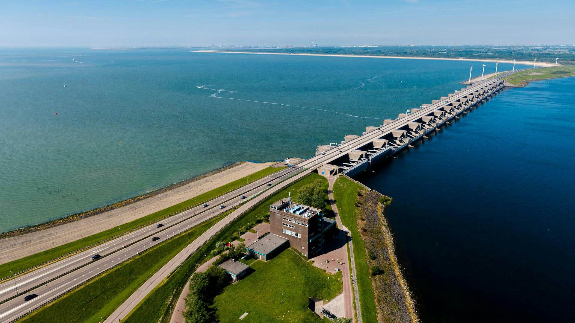
Haringvliet Dam
The name 'Haringvliet Dam' doesn't quite do justice to this enormous Delta Work. The Haringvliet Dam actually consists of a dam, a barrier, sluice gates, and a navigation lock.
The complex is located in the Haringvliet River, between Voorne-Putten and Goeree-Overflakkee. It discharges up to 70% of the water from the Rhine and Meuse rivers into the North Sea. By opening and closing, the Haringvlietdam regulates the water level for a large area. For this reason, this Delta Work is also known as the 'Valve of Europe'.
The Haringvliet Dam in statistics
- Built between 1958 and 1970
- 4.5 kilometres long with 1 kilometre of sluice gates
- 17 sluice openings with 34 gates, each 56 metres wide
- Over 22,000 piling foundations
- Discharges 30 billion cubic metres of water annually

Origins
The closure of the Haringvliet was a key component of the Delta Plan, aimed at shortening the coastline and thus reducing the work required on the many dikes. For this reason, it was one of the first projects. However, the construction was not easy and would take 12 years to complete.
The biggest challenge was the vast amounts of water from the Rhine and the Meuse that are discharged into the sea through the Haringvliet. A complete closure was therefore not possible. Additionally, space had to be maintained for shipping.
The Haringvliet Dam therefore consists (from north to south) of a dam, seventeen sluice gates (which discharge river water and prevent seawater from entering), another section of dam, a navigation lock, and finally, another stretch of dam towards Goeree-Overflakkee. A road runs across the entire structure, connecting the islands of South Holland.
As a bonus, this also created a large reserve of freshwater behind the Haringvlietdam. The strong current of the river water keeps the salty seawater out. The freshwater could then be used for agriculture and as drinking water.
Construction
Because ships had to continue passing during construction, it was impossible to close the opening all at once. Therefore, a work island and a work harbour were built first.
The work began in 1956 with the creation of a 'polder'. Across the current, a massive construction pit was created, surrounded by dikes: 1.4 kilometres long and 560 metres wide. This allowed ships to continue passing alongside the work island.
The sluice gates were built in the construction pit. Each gate was fitted with two sluices: one on the seaward side and one on the river side. The sluices on the seaward side are designed to break the force of the waves, while those on the river side form the actual barrier that keeps seawater out. The sluices are particularly wide, as they must be able to allow ice floes to pass under special circumstances. The sluices were suspended from the bridge and, when open, had to provide a clearance of 6 metres for vessels.

Due to the extremely strong current, special triangular girders were designed for the bridge, on which the span (the bridge) could rest. Because of their shape, these girders are called 'NABLA girders', named after the ancient Greek word νάβλα for a harp from ancient Israel.
Once the sluice gates were completed, a cableway several meters high was stretched from the work island to Voorne-Putten. The dikes around the work island were removed, and via the cableway, 93,000 enormous concrete blocks were brought in and dumped into the river at the locations that had not yet been sealed. This cableway had been used earlier in the construction of the Grevelingen Dam. It was a second trial, to see if this technique could also be used in the wide sea arms where the Brouwers Dam and the Eastern Scheldt Storm Surge Barrier were to be built. In addition to the concrete blocks, the dam was filled with sand and stone.
In 1970, the Haringvliet Dam was completed, and in 1971, the first cars drove over the structure. It was a massive project that Rijkswaterstaat was eager to showcase to the public. For the first time, a visitor centre was built to provide information about the project. In 2016, the Cultural Heritage Agency of the Netherlands designated the Haringvliet Dam as a national monument.
Functioning
Rijkswaterstaat operates the 17 sluice openings with 34 gates 24 hours a day. The timing of their opening and closing depends on the amount of water entering the country at Lobith (Rhine) and Borgharen (Meuse). When the river water levels are too high, the sluices discharge the excess water.
Since 2018, the Haringvliet Sluices also function as storm surge barriers in addition to sluices. During high tide, the gates now open slightly to allow fish the opportunity to swim upstream into the inland waters. This small gap creates a more natural transition between freshwater and saltwater. The gates cannot open fully, as this would make the water behind the dam, which is used for drinking water and agriculture, too salty.

Goereese sluis
The 'Goereese sluis' is the separate lock for shipping in the southern part of the Haringvliet Dam. It is not located directly next to the sluices, so that shipping traffic is not affected by the current.
The lock has a chamber length of 144.5 metres and is 16 metres wide. The threshold of the lock is 5 metres below sea level, allowing vessels with a draught of up to 3.5 metres to pass even when the water level is low.


