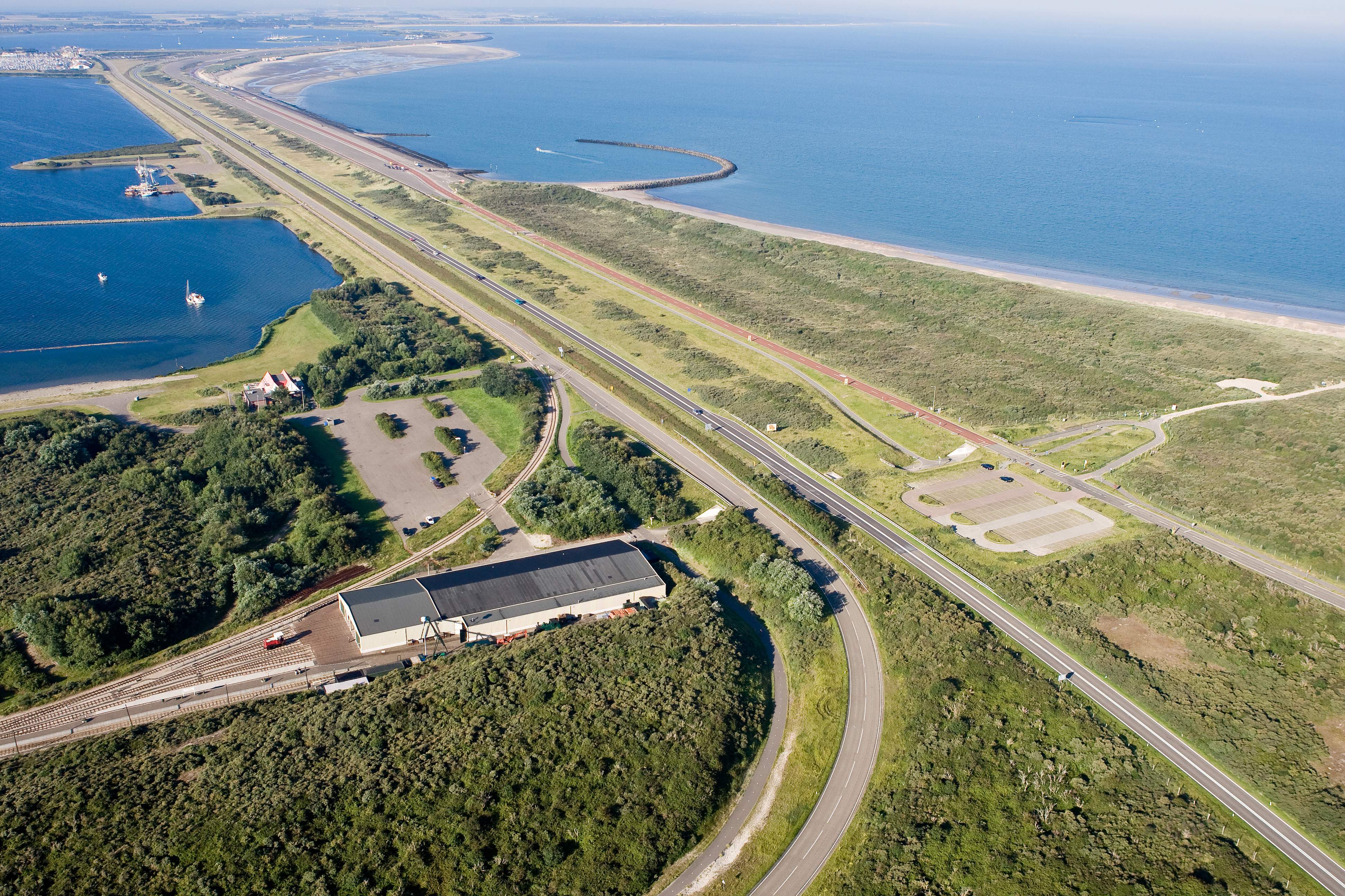
Brouwers Dam
The Brouwers Dam is the largest Delta Works project after the Eastern Scheldt Storm Surge Barrier.
The dam is located in the former sea arm, Brouwershavense Gat, between Goeree-Overflakkee and Schouwen-Duiveland. It protects against high water and strong waves from the sea. An access road also runs across the dam.
The Brouwers Dam in statistics
- Built between 1962 and 1971
- 6.5 kilometers long
- 12 meters high
- 240,000 concrete blocks, each weighing 2500 kg
- 12 caissons, each 68 meters long, 18 meters wide, and over 16 meters high
- 2 landhead caissons
- 3 locks, each 195 meters long

Origin
One of the main goals of the Delta Plan was to shorten the coastline, reducing the need to maintain (high) dikes. The Brouwers Dam was one of the most effective ways to do this. It also served as a good practice for building the more complicated Eastern Scheldt Storm Surge Barrier.
To protect Goeree-Overflakkee and Schouwen-Duiveland, the dam had to be built as far out to sea as possible. From the tip of Goeree-Overflakkee, the sandbank Kabbelaarsplaat was used, and from there, the crossing to Schouwen-Duiveland was made via the next sandbank, Middelplaat. This route was 20% to 30% cheaper than alternatives and was also the shortest for traffic between the Oosterschelde barrier and the Brouwersdam.
Consideration was also given to how the Brouwers Dam would fit into the landscape. Halfway along the dam, space was created for beaches, a marina, and holiday bungalows (now known as Port Zélande). Today, the dam hosts the annual Concert at Sea, which attracts more than 40,000 visitors.
Construction
On September 25, 1962, the government initiated the construction of the Brouwers Dam. The first step was to pump sand to merge the Kabbelaarsplaat and Middelplaat into one sandbank. This headland then served as a working island. Two flow gaps remained in the sea arm: a northern and a southern gap.

To close the northern gap, from Kabbelaarsplaat to Goeree-Overflakkee, twelve caissons were used, along with two ‘landhead caissons’. These hollow concrete structures, the size of apartment buildings, were first used during World War II. The Allies used them to create artificial quays at the Normandy invasion beaches. They were also used in the closing of dike gaps in Walcheren in 1945 and Ouwerkerk in 1953. The Watersnoodmuseum is housed in one of these caissons!
The caissons used in the Brouwers Dam were specifically designed to be permeable, allowing water to pass through during placement to prevent being swept away by the current. Once all the caissons were positioned correctly, the openings were closed using gates during slack tide when the current was minimal. The caissons were then filled with sand and stone, effectively closing the northern gap of the Brouwers Dam.
The southern gap, from Middelplaat to Schouwen, was too deep to be sealed with caissons. Instead, a cable car was set up with gondolas to drop concrete blocks weighing up to 2500 kg into the water. This method had previously been used on a smaller scale at the Grevelingen Dam. For the Brouwers Dam, 240,000 blocks were needed to form the basic structure of the dam. The gaps between the blocks were filled with sand to prevent water from passing through. The dam was completed in 1971, and two years later, the roadway was opened.
Brouwerssluis
The construction of the Brouwers Dam had a significant impact on the surrounding nature. By closing off Lake Grevelingen from the North Sea, the water in the Grevelingen became stagnant, leading to brackish conditions. As a result, several plant and animal species disappeared, including small shellfish that died within days and saltwater-dependent plants that could no longer survive. Within weeks of the closure, decaying plants and animals were seen floating throughout the area.

To restore the ecosystem, Rijkswaterstaat constructed the Brouwerssluis in 1978. The sluice consists of two concrete tubes, each 195 meters long, and a fish pass of equal length. This allows seawater to flow freely into and out of the Grevelingenmeer, which has become the largest saltwater lake in Western Europe, covering 11,000 hectares.
Plants and animals are gradually returning to the area. Flounders can now swim freely from Lake Grevelingen to the North Sea, and the oyster, once thought to be extinct, has returned. However, the deeper layers of the lake lack sufficient oxygen for underwater life. To address this, plans are in place to create openings in the dam, allowing limited tidal flow to help refresh the water.
In other parts of the Lake Grevelingen, nature has changed due to the limited tidal flow, which has dried out the land. Oystercatchers have disappeared from the area, replaced by avocets, plovers, lapwings, and little terns. Today, Hompelvoet Island in Lake Grevelingen has become one of the largest breeding grounds for the common tern in the Delta region, with 3,000 breeding pairs.


